
Chattogram City Corporation
Located in southeastern Bangladesh, Chattogram City Corporation administers Chittagong, the nation's second-largest city and a vital port for international trade.
On the map
2 / 3 have a pinData © OpenStreetMap contributors
By category
Recently added
See all 3 →Southern University Bangladesh
University · Chattogram
University of Science and Technology Chittagong (USTC)
University · Chattogram
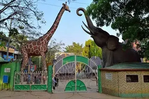
Chattogram Zoo
Park · Chattogram
Thanas in Chattogram City Corporation (16)
Post offices in Chattogram City Corporation (48)
See all 48 →- Agrabad Town sub office Code 4000
- Agrabad Night Town sub office Code 4100
- Al-Amin Baria Madrasha Sub office Code 4221
- Amin Jute Mills Town sub office Code 4211
- Anandabazar Sub office Code 4215
- Azimpara Sub office Code 4000
- Central Govt. Office Building Town sub office Code 4000
- Chakbazar night Sub office Code 4203
- Chaktai Town sub office Code 4000
- Chandgaon Town sub office Code 4212
About Chattogram City Corporation
Chattogram City Corporation is situated in the southeastern part of Bangladesh, specifically within the Chattogram Division and Chattogram District. Its boundaries encompass an area of 168.99 square kilometers, bordering Hathazari and Sitakunda Upazilas to the north, Anwara and Patiya Upazilas to the south, Boalkhali and Raozan Upazilas to the east, and the Bay of Bengal to the west.
The area now known as Chattogram has a long urban history, functioning as an important seaport from at least the 9th century. It passed through the control of various local rulers and the Bengal Sultanate before being incorporated into the Mughal Empire in 1666, when it was renamed Islamabad. Following British colonial rule, the port was modernized and expanded, and a municipal system was introduced. After Partition in 1947, it became part of East Pakistan and later Bangladesh, being upgraded to a City Corporation in 1990.
The city’s landscape is shaped by its coastal location and proximity to the Karnafuli River. Historical evidence suggests that Arab, Persian, and Chinese traders frequently used the port, contributing to its growth as a center of international commerce. The area's terrain varies, including hilly regions and flat coastal plains.
The city's history and strategic location have contributed to a diverse cultural landscape. The city is divided into 41 wards and 211 mahallas, each represented by elected councillors. The CCC coordinates with other authorities to provide essential services and improve the quality of life for residents.
Key contacts
-
Mayor
-
Nagar Bhaban (city office)
Nagar Bhaban, Gulshan Center Point, Plot# 23-26, Road# 46, Level-08, DNCC Gulshan-2, Dhaka-1212
Emergency numbers